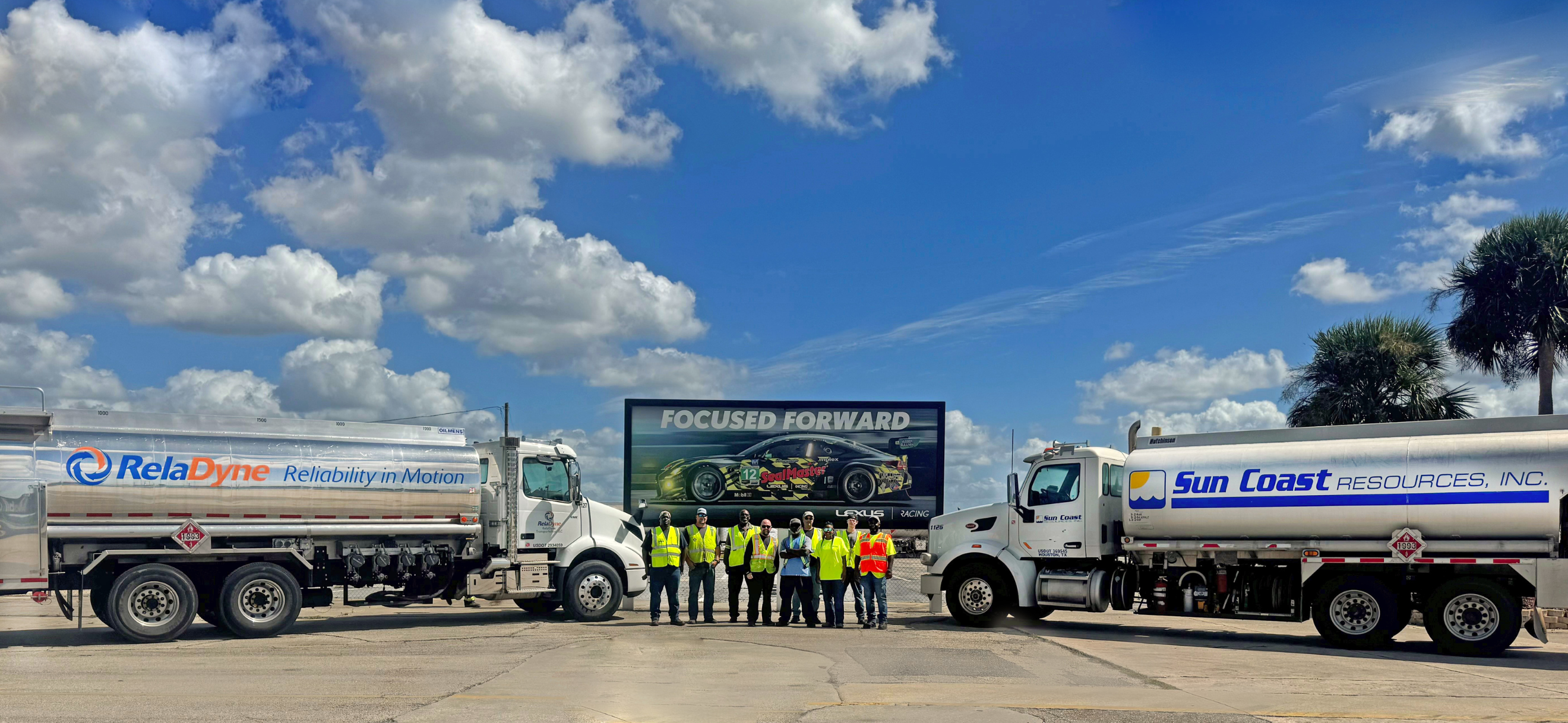
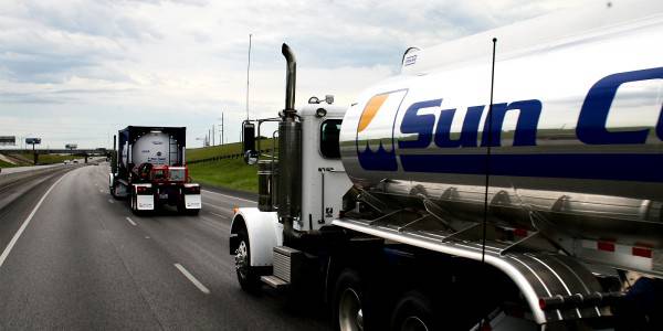
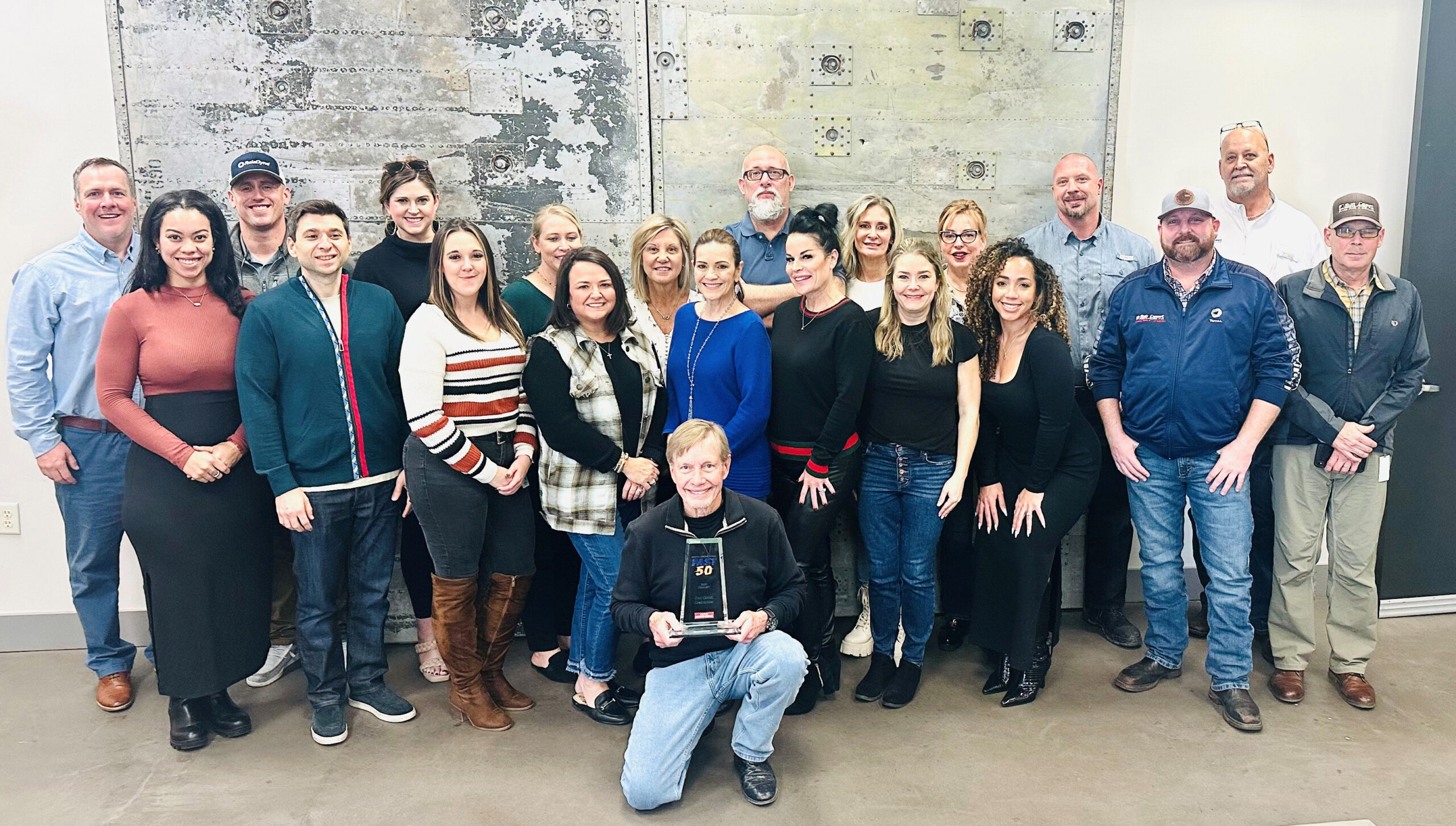
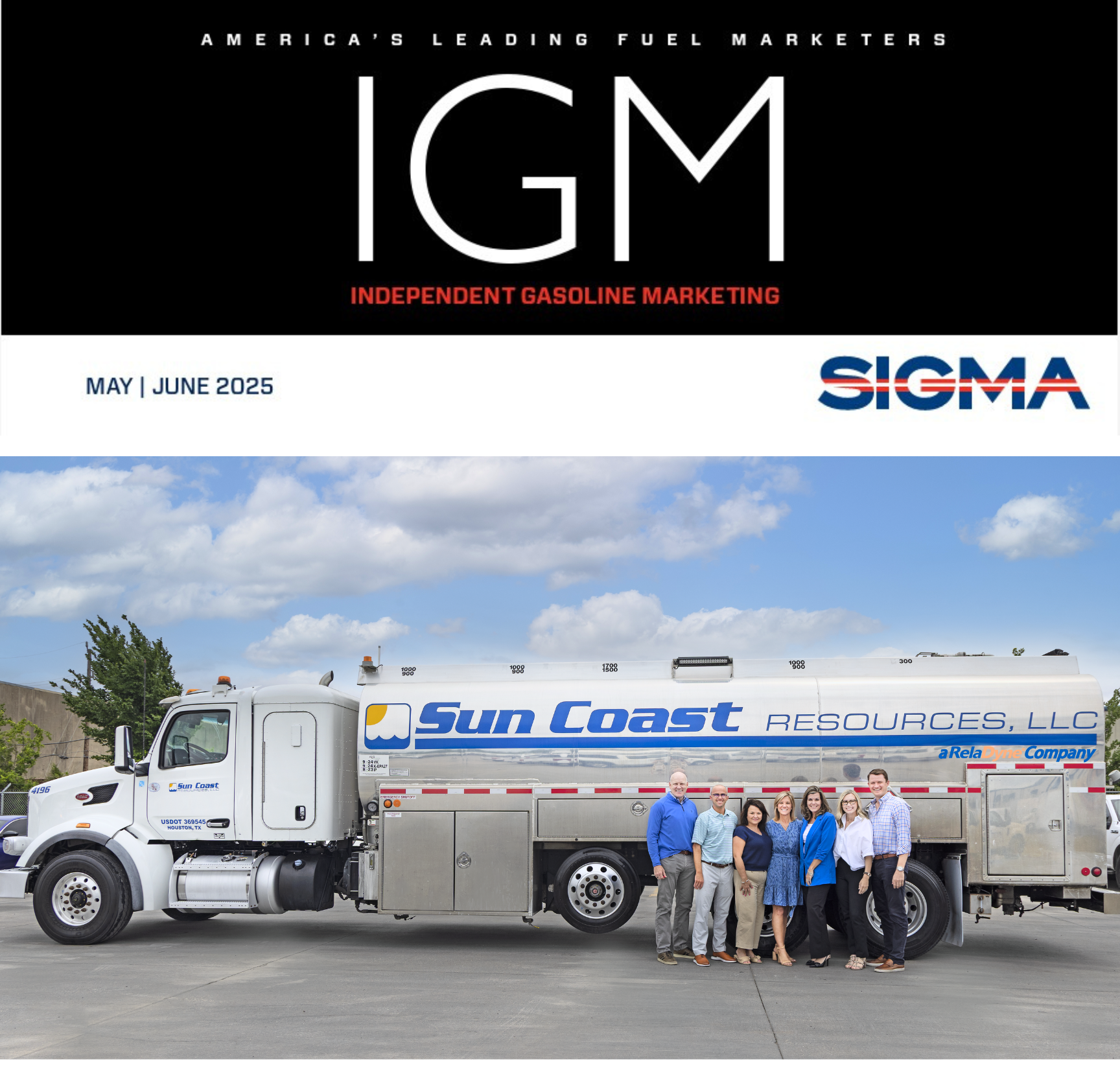
Emergency Fuel Response to Tornado Areas

Emergency Fuel Response to Tornado Areas

May 21, 2013 – Sun Coast Resources, Inc. has responded with emergency fueling equipment to Moore, OK and other affected areas devastated by recent tornadoes. Sun Coast is providing fuel for first responders and rescue and recovery vehicles, as well as generators so police, firefighters and other emergency personnel can stay up and running during this period of trauma and peril. Sun Coast employees are donating clothes, shoes, towels, wash cloths and non-perishable food items as well.  If you are without power and fuel, please use our emergency line at (800) 677-FUEL (3835) extension 567 or email at emergencyfuel@suncoastresources.com.

Since Kathy Lehne, founder, president and CEO of Sun Coast Resources, Inc., opened her doors in the spring of 1985, Sun Coast has become one of the largest wholesale petroleum marketers in the nation. In an effort to help during the horrible aftermath of a storm ten years ago, Sun Coast created its Emergency Fuel Response division, and has been responding to natural disasters ever since.

According to Kyle Lehne, Sun Coast’s Vice President of Emergency Response, “Our hearts and prayers are with those families who lost loved ones, as well as their homes and possessions.  No one can imagine the pain and suffering they are going through; but we are confident they will rebuild their homes and regain their hope for the future.”

Sun Coast is one of the nation’s largest Emergency Fuel service providers, having responded to 41 natural disasters in the past decade.  Sun Coast specializes in generator and on-site fueling during periods when electricity is not available and when fuel supplies are curtailed. Sun Coast also has a Mobile Field Command Center and a fleet of RVs for temporary housing for use during disaster response activities. Sun Coast provides fuel supply services and equipment to governmental agencies, utilities, communication companies, delivery services and other fleet operators when emergency situations such as hurricanes, floods, tornadoes and other severe weather conditions and related natural disasters create power interruptions, supply outages, or supply access restrictions.

Sun Coast has a working inventory of over 10,000 fuel and lubricant tanks in support of its outstanding tank loan program, including skid mounted and overhead tanks, frack tanks, aviation certified tanks, lubricant tanks, and emergency ISO tanks.  Sun Coast’s delivery fleet includes transports, bobtails, vacuum trucks, lube trucks, lowboys, pick-ups and roll-backs for relocating tanks and equipment.

Sun Coast provides prompt, courteous personalized service 24 hours a day, 7 days a week, and is licensed to do business in 39 states. Sun Coast understands and appreciates the importance of high quality, competitively priced products, superlative customer focus and friendly service. Contact www.emergencyfuel.net or 800-677-FUEL (3835) ext. 567.

###

 Sun Coast Resources’ emergency fuel response teams are ready to help those in need with the effects left behind from the tornadoes. 


When you need red diesel for your generator, Sun Coast is there!  When you need a dedicated fuel truck for your multiple business locations, Sun Coast is there!  When you need a double wall insulated tank to dispense gas or diesel, Sun Coast is there!  When your fleet needs fueling because the gas stations are without gas or power, Sun Coast is there!  When your current fuel supplier runs out of its fuel supply, Sun Coast will be there! Be prepared by being RESOURCEFUL!

Sun Coast Resources has over 1,000 trucks and equipment to serve you across 35 States and always 24/7/365.  Sun Coast never sleeps!

If you are not affected by the storms, do you have your emergency plan and generator maintenance schedule with Sun Coast already?


Severe Storms Across Gulf Coast

Severe thunderstorms ravished parts of the Gulf Coast states Sunday and the threat will continue into Monday.

The worst damage on Sunday occurred in and around Hattiesburg, Mississippi where a long-track tornado ripped across parts of four counties.

The severe thunderstorm threat may continue through Monday and Tuesday in Louisiana, Alabama, Mississippi, Georgia and parts of Florida.  In addition, heavy rainfall through at least Wednesday may lead to flash flooding in parts of the Gulf South.

Sun Coast Resources’ emergency fuel division is ready for your unleaded gasoline or diesel fuel needs for your generators, or if you need a dedicated fuel truck or fuel storage tank, call our emergency line now at 800-677-FUEL (3835) extension 567www.emergencyfuel.net

Sun Coast Resources is here to help around the clock, every day of the year.

Emergency Fuel Available For Winter Storm Nemo and Orko

Nemo, the winter storm packing hurricane-force wind gusts and blizzard conditions swept through the Northeast overnight, where more than 650,000 homes and businesses in the densely populated region lost power and New Englanders awoke Saturday to more than 2 feet of snow.

More than 38 inches of snow fell in Milford in central Connecticut, and an 82-mph wind gust was recorded in nearby Westport. Areas of southeastern Massachusetts, Rhode Island and New Hampshire notched at least 2 feet – with more falling. Airlines scratched more than 5,300 flights through Saturday, and the three major airports serving New York City as well as Boston’s Logan Airport closed.

About 650,000 customers in the Northeast lost power during the height of the snowstorm, most of them in Massachusetts and Rhode Island. The Pilgrim Nuclear Power Plant in Plymouth, Mass., lost electricity and shut down Friday night during the storm. Authorities say there’s no threat to public safety.

Blizzard warnings are in effect from coastal Maine to northern New Jersey, including Portland, ME; Boston, MA;  Hartford, CT; Providence, RI; and Concord NH; to the New York City metro area and Long Island.

Winter Storm Orko will deliver a swath of heavy snow and strong winds to the northern Plains and Upper Midwest Sunday. The southern end of the storm system associated with Orko will have the potential to bring severe thunderstorms and heavy rain to parts of the South.

Sun Coast Resources’ emergency fuel division has been in the Northeast since Superstorm Sandy ravaged that area, and we deployed even more fuel trucks to that region on February 7th. If you or your business is in need of unleaded gasoline or diesel fuel for your generators, or need a dedicated fuel truck or fuel storage tank, call our emergency line now at 800-677-FUEL (3835) extension 567www.emergencyfuel.net

Sun Coast Resources is here to help around the clock, every day of the year.

Other storm watches:

Beginning late Saturday into Saturday night, some severe storms may fire up in parts of west Texas and southwest Oklahoma and then spread eastward to perhaps near or east of the I-35 corridor by early Sunday morning. Damaging winds and hail are the main threats, however we cannot rule out the possibility of an isolated tornado.

Sunday, the coverage of rain and thunderstorms will expand greatly. These thunderstorms will have the potential to produce damaging winds, large hail and isolated tornadoes and may be ongoing during the morning in eastern Texas. From there, this severe storm threat could spread all the way to the lower-Mississippi Valley.

Sun Coast Driver, Mike Phillips, rolls out of the Houston yard last night on his way to the Northeast.

Emergency Fuel Needs During Winter Storms

Sun Coast Resources’ Emergency Fuel division is ready should you need gasoline, diesel or dye diesel due to power outages from the storms.

Weather.com warns, “One of our biggest concerns is the amount of wind energy carried by this large-scale storm system. Jet stream winds are forecast to easily exceed 150 miles per hour with this system. But more alarmingly, the winds in the lower atmosphere are also expected to be fierce – with the potential for southerly winds of 90 to 105 miles per hour just 5,000 feet above the ground in some areas just ahead of the cold front.  That combination of powerful wind energy and an unstable atmosphere – even an only weakly unstable one as we often see in January – may lead to widespread straight-line wind damage along with the potential for a few tornadoes.  In addition, with such a strong wind field accompanying this system, individual thunderstorms or squall lines are likely to move forward lightning-quick, at speeds of 50, 60, even 70 miles per hour, making quick action all the more important if and when severe weather warnings are issued.

These strong southerly winds ahead of the cold front will also bring unusually moist air well north of the Ohio River. For some areas it will be among the most humid January air masses in recent history, and the resulting heavy rainfall threat over frozen ground has prompted the National Weather Service to issue flood watches parts of the Upper Midwest, including Chicago, Detroit, Milwaukee, and Indianapolis. (Scroll down for more links to watches and warnings.)”

Sun Coast Resources’ emergency fuel response teams are ready to help!  When you need red diesel for your generator, Sun Coast is there!  When you need a dedicated fuel truck for your multiple business locations, Sun Coast is there!  When you need a double wall insulated tank to dispense gas or diesel, Sun Coast is there!  When your fleet needs fueling because the gas stations are without gas or power, Sun Coast is there!  When your current fuel supplier runs out of its fuel supply, Sun Coast will be there! Be prepared by being RESOURCEFUL!

Suncoast staff

Sun Coast Resources has over 1,000 trucks and equipment to serve you across 35 States and always 24/7/365.  Sun Coast never sleeps!

If you are not affected by Winter storms, do you have your emergency plan and generator maintenance schedule with Sun Coast already?


Sun Coast Emergency Fuel Is Ready for Winter Storm Kahn

Winter Storm Khan brought a swath of snow from the Midwest to the Mid-Atlantic today. Parts of the South, including southern Kentucky, Tennessee, South Carolina and North Carolina have seen significant icing from the storm.

Sun Coast Resources’ emergency fuel response teams are ready to help those in need with the effects left behind from Winter Storm Kahn.  When you need red diesel for your generator, Sun Coast is there!  When you need a dedicated fuel truck for your multiple business locations, Sun Coast is there!  When you need a double wall insulated tank to dispense gas or diesel, Sun Coast is there!  When your fleet needs fueling because the gas stations are without gas or power, Sun Coast is there!  When your current fuel supplier runs out of its fuel supply, Sun Coast will be there! Be prepared by being RESOURCEFUL!

Suncoast staff

Sun Coast Resources has over 1,000 trucks and equipment to serve you across 35 States and always 24/7/365.  Sun Coast never sleeps!

If you are not affected by Winter storm Kahn, do you have your emergency plan and generator maintenance schedule with Sun Coast already?


Emergency Fuel Response Team Prepares for Sandy…

frankenstorm sunday

Hurricane Sandy “Frankenstorm” continues to head in the Northeast with torrential rainfall, high winds, high tides, possible snow with power outages expected.  Sun Coast Resources is here to assist all of the areas that will be affected by the flooding, winds and dangerous waves. Contact Sun Coast’s EMERGENCY FUEL division for emergency fuel, emergency diesel, emergency generators, on-location fuel tanks, dedicated fuel trucks, generator fuel and other related services.

Sun Coast Resources’ fleet of 1,000 vehicles will assure you that we deliver fuel 24/7 to 35 States when an emergency happens.  Be prepared and be RESOURCEFUL.

View our Emergency Fuel page for more information.
Call 800-677-FUEL (3835) ext.567

or send us an email to Emergency@suncoastresources.com

  • Free Price Quote
  • Get the lowest price for emergency diesel
  • Free Product Cross Reference
  • Get the best products, fuel, diesel, emergency generators
  • Free Product Consolidation Analysis
  • Get the most effective service, tanks, dedicated trucks

This weather monster that U.S. forecasters call “Frankenstorm” is looking ominous by the hour.  Meteorologists expect a natural horror show of heavy rain, high winds, extreme tides and snow for several days on the East Coast.

Preparedness and safety Tips for Hurricane Sandy for Communities and Businesses

Each year during hurricane season, people living along coastal and inland communities face the danger of these powerful storms. In 2005, Hurricane Katrina became the costliest and deadliest storm taking more than 1,300 lives and costing US$125bn.
To best prepare for the unpredictable impact of hurricanes, municipalities, academia and businesses should all ensure that:
•    Severe weather alerts are integrated with your mass communication system with automated calls-to-action for emergency responders and constituents.
•    Your weather alerts include lightning, high winds, flash floods and flooding – all weather related to hurricanes.
•    Stock up on water and food supplies as well as fuel for your generators.
•    Promote multiple contact paths for each member of your system to ensure that people, not just devices are reached.
•    Make sure adequate and recent testing of the system and its contact data has been done to guarantee expected results.
•    All emergency responders are trained on how to initiate communications from their mobile devices using lists and map-based capabilities and do not have to rely on being at the office or in front of a computer.
•    Constituents are empowered with mobile apps that they can use to proactively communicate their status and need for emergency response.
•    Social media sites like Twitter are being monitored for real-time, location-specific impact to individuals and communities.
•    Important internal, external & social media information can be aggregated in a single console to deliver situational intelligence to emergency response teams as soon as possible
•    The emergency plan for hurricanes includes appropriate communications at every stage of the incident lifecycle.

Isaac Power Outages map…

Hurricane Isaac made land fall last night and has dropped a ton of rain and the power outages have started across Louisiana and Mississippi.  The storm surge tops the levee and floods homes.  In emergency response situations where your business needs fuel for its fleet and generators, the experienced team at Sun Cost Resources is prepared.  Trucks were deployed yesterday and have been strategically staged around Louisiana and Mississippi.  Call the emergency hotline 24 hours a day at 800-677-3835 ext. 567 or visit the website for more information at www.emergencyfuel.net.

For an update on weather visit: http://www.weather.com/news/weather-hurricanes/hurricane-isaac-impacts-wednesday-20120829

Emergency Fuel Supplier for Isaac and Other Hurricanes Available 24/7


Sun Coast Resources, Inc. has provided emergency fuel for over 27 years and to over a dozen natural disasters.  Call the experienced fuel and tank distributor 24/7 across Louisiana, Texas, Mississippi, Alabama, Florida and any of our other 35 licensed States. Please see our website for all the specifics about how we can serve you with: emergency response, dedicated fuel trucks, fuel tanks, generator fuel, mobile fuel trucks, diesel and more…

http://www.suncoastresources.com/emergency-fuel-response/tank-retainer-program/


Tropical Storms, Tornadoes and Flooding…

The past week has been an active week of storms.  A destructive derecho swept across the Midwest Saturday, bringing heavy rains and damaging winds and causing organizers to evacuate the popular concert Lollapalooza in Chicago and resulted in about 150,000 customers who lost power.  Elmira, NY experienced an EF-1 tornado on July 26th. The twister produced winds of 105 to 110 mph. The winds brought down trees, many falling into parked vehicles and power lines.  Also, all eyes were on Tropical Storm Ernesto and the path it might take in the next several days. Meanwhile, Florence has formed in the Atlantic Ocean off the coast of Africa.

Remember, during this storm season, Sun Coast Resources is experienced and able to assist all of the areas that might be affected by flooding, dangerous waves and loss of power. Contact Sun Coast’s EMERGENCY FUEL division for emergency fuel, emergency diesel, emergency generators, on-location tanks, dedicated trucks, generator fuel and other related services.

Call 800-677-FUEL (3835) ext.567
or send us an email to Emergency@suncoastresources.com

■Free Price Quote
Get the lowest price for emergency diesel
■Free Product Cross Reference
Get the best products, fuel, diesel, and emergency generators
■Free Product Consolidation Analysis
Get the most efficient service, tanks, and deliveries that are always prompt

View our Emergency Fuel page for more information. http://www.suncoastresources.com/emergency-fuel-response/


Tropical Depression THREE-E and Altlantic Activity Update

The National Hurricane Center has issued an advisory on the tropical depression “THREE-E”. As you see in the provided image, the tropical depression is south of Mexico.
NHC Image Map of THREE-E
Current reports and forecasts from the National Hurricane Center indicate that the tropical depression will increase to a tropical storm with wind speeds up to 73mph. The storm is predicted to continue west/northwest into the Pacific. With its currently forecasted track, it is likely to only affect small areas of Mexico and possibly some Pacific Islands near Mexico. The storm currently presents no threat to the US.


Atlantic Activity Update

Atlantic Activity by the NHC

TROPICAL WEATHER OUTLOOK
NWS NATIONAL HURRICANE CENTER MIAMI FL
800 PM EDT THU JUL 7 2011


FOR THE NORTH ATLANTIC…CARIBBEAN SEA AND THE GULF OF MEXICO…

1. AN ELONGATED LOW PRESSURE SYSTEM LOCATED ABOUT 300 MILES SOUTHWEST
OF TAMPA FLORIDA HAS BECOME A LITTLE BETTER DEFINED DURING THE PAST
FEW HOURS. IN ADDITION…SURFACE PRESSURES HAVE DECREASED OVER THE
EASTERN GULF OF MEXICO DURING THE LAST 24 HOURS. ENVIRONMENTAL
CONDITIONS ARE EXPECTED TO BECOME MARGINALLY CONDUCIVE FOR SOME
ADDITIONAL DEVELOPMENT OF THIS DISTURBANCE. THERE IS A MEDIUM
CHANCE…40 PERCENT…OF THIS SYSTEM BECOMING A TROPICAL OR
SUBTROPICAL CYCLONE DURING THE NEXT 48 HOURS AS IT MOVES SLOWLY
NORTHWARD OR NORTH-NORTHEASTWARD. REGARDLESS OF DEVELOPMENT…THIS
WEATHER SYSTEM WILL PRODUCE PERIODS OF LOCALLY HEAVY RAINFALL
ACROSS MOST OF THE FLORIDA PENINSULA AND THE EASTERN FLORIDA
PANHANDLE DURING THE NEXT COUPLE OF DAYS.

2. A TROPICAL WAVE LOCATED ABOUT 400 MILES EAST-SOUTHEAST OF THE
SOUTHERN WINDWARD ISLANDS CONTINUES TO PRODUCE A DISORGANIZED AREA
OF SHOWERS AND THUNDERSTORMS. ALTHOUGH SIGNIFICANT DEVELOPMENT OF
THIS SYSTEM IS NOT EXPECTED…LOCALLY HEAVY RAINS ARE POSSIBLE OVER
NORTHERN SOUTH AMERICA AND THE SOUTHERN WINDWARD ISLANDS DURING THE
NEXT DAY OR TWO. THERE IS A LOW CHANCE…10 PERCENT…OF THIS
SYSTEM BECOMING A TROPICAL CYCLONE DURING THE NEXT 48 HOURS.

ELSEWHERE…TROPICAL CYCLONE FORMATION IS NOT EXPECTED DURING THE
NEXT 48 HOURS.

Source Page, National Hurricane Center

In just the first week of July the Atlantic has been more active than last month. Be sure to get prepared and have your emergency plan and gear in place. For tips on Hurricane Preparation visit our Hurricane Headquarters pages.

For emergency 24/7 fueling from Sun Coast Resources, call 713-336-4567 or visit our emergency services at www.EmergencyFuel.net.