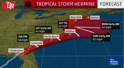
Hermine has now weakened to a tropical storm since hitting landfall and moving farther inland across the Southeast states early Friday morning. Heavy rain from Hermine will continue to impact a swath from Florida to Georgia and the Carolinas on Friday. Tropical storm-force winds, isolated tornadoes and storm surge flooding are also threats in that same area.
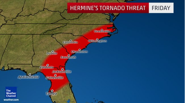
As with most landfalling tropical cyclones, there is a threat of tornadoes embedded in rainbands. Today, this threat is focused from north Florida to the eastern Carolinas. An isolated tornado threat may continue Saturday in eastern North Carolina and far southeast Virginia. Due to this, the Storm Prediction Center (SPC) has issued a tornado watch valid until 4 p.m. EDT for coastal portions of Georgia, South Carolina and southeast North Carolina. This watch includes Charleston, South Carolina, and Savannah, Georgia.
Sun Coast is here to help you prepare and respond with disaster planning services, response and priority agreements, emergency fleet and generator fueling, storage tanks, mobile fueling stations, generator services, vacuum truck services and more.
Contact us today at 800-677-FUEL (3835) Ext. 567 or email emergency@nullsuncoastresources.com.
Visit weather.com for up to date weather information.


